No longer only a tool for science, landform mapping and Geomatics Engineering, we have expanded our LiDAR (Light Detection and Ranging) usage by further analyzing, managing and manipulating the LiDAR data sets across a host of practical applications. This understanding of how to fully utilize and interact with LiDAR data is allowing us to design and create structures and systems – notably in the building, infrastructure and in situ environments – that are safer and more resilient.
But what’s fascinating is that we are still just beginning to achieve LiDAR’s potential for information gathering and usage. One emerging market that Michael Baker is focusing on is in enabling autonomous vehicles while building safer, smarter, real-time information systems within our transportation networks. The impact and applications for this type of ubiquitous, low-cost form of mass-produced LiDAR technology associated with automotive, rail, airborne, marine and other vehicles can change the way the world moves people and things.
 |
| What you see is what you get (WYSIWYG) with Mobile LiDAR. Completely immersive scenes are generated along transportation corridors for an array of applications. |
The LiDAR data we collect at Michael Baker is of a very precise and dense variety. We apply LiDAR to the purpose of very selective illumination of phenomena in the line-of-sight of our sensor systems. We are selective in where and how we deploy our systems and we carefully plan collections. We primarily direct our LiDAR sensors at our customers’ infrastructure or assets for the comprehensive collection of a point cloud that will be analyzed to extract very specific information. Combined with the acquisition of panoramic and other imagery, our LiDAR and imagery data becomes quite massive in terms of the individual artifacts of data created within the collection process. Now we’re developing methods and algorithms that interact directly with these point clouds to perform conformity analysis with design standards and to analyze stress and perhaps load forecasting on infrastructure. This is the way we can extend the potential for that infrastructure though effective operation and maintenance practices, as well as predict the infrastructure’s ability to bear existing or additional demand loads.
 |
| Critical infrastructure is accurately mapped with application of sound surveying principles. |
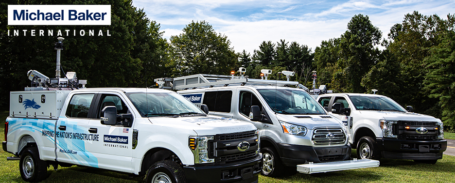
With our Mobile LiDAR capabilities a single vehicle has the potential to collect in excess of a terabyte of data each day. Billions of LiDAR shots are recorded, tens of millions of photographs are taken and hundreds of thousands of individual LiDAR-based files are generated in a relatively short time period as part of the overall process of creating LiDAR deliverables for a typical project. We currently operate four extraordinarily hi-tech Mobile LiDAR systems, running a collective 800 days per year. We annually collect LiDAR to create more than a petabyte of raw engineering quality data to produce discrete, extracted information about specific infrastructure, assets or ecosystems. After collection, we may double the amount of data we produce and manage for the deliverables we derive from the raw LiDAR or images. Accurately and cost-effectively creating and managing such information is a constant challenge for a large scale LiDAR operation such as ours.
The laser sensors we employ are generally indiscriminate when collecting data. A pulse is emitted and returned. We collect everything in the line-of-sight potential of our eye-safe lasers with great precision. Then we analyze the aggregation of billions of LiDAR points within a dataset to determine any phenomena and its relevancy to an intended purpose.
 |
| The use of highly detailed Mobile LiDAR datasets provide the mechanism for feature extraction and attribution when used in conjunction with 360° spherical photography. |
As we continue to find new data to mine and explore all of the possibilities that LiDAR technology affords the transportation industry, it’s exciting to ponder the industry’s evolution and what the future looks like.
I invite you to join me at the
2016 MAPPS Winter Conference for a presentation titled: “Big Data or Data That’s Big? The Pervasiveness of LiDAR in the Approaches to Engineering” as I am further addressing these topics and how we are managing data. And, continue to follow this blog for future insights.
Cheers!
Bob


