Tuesday, December 14, 2010

Coloring the Cloud

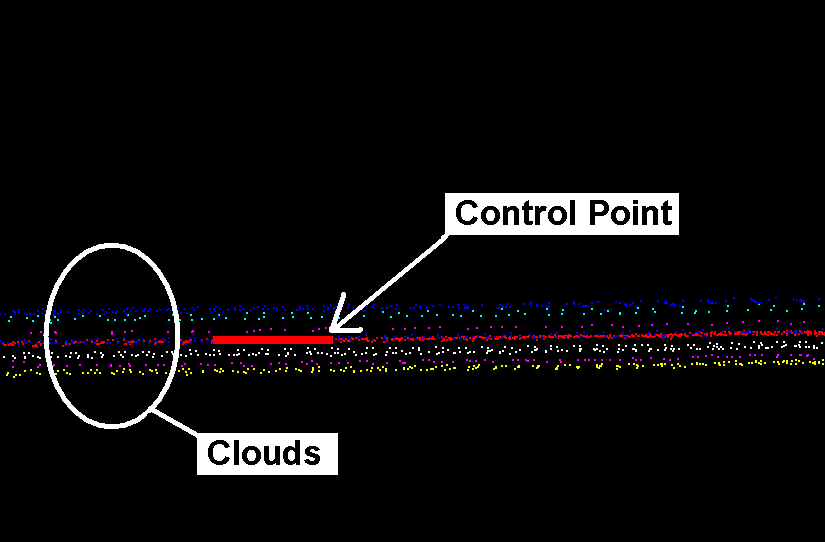
Nearly a year ago, I wrote a posting titled Measurement Systems Part 2 - Lasers and Cameras.  In it, I first presented how the combination of the Mobile LiDAR data and imagery from the system's on board cameras are combined to create colorized point clouds.  Having a broad static scanning background, I often went through great lengths to recapture pictures to improve the colorized cloud. We face similar challenges with the Mobile LiDAR system.  With proper planning, patient operators, creative scheduling and a little bit of luck, the results can be impressive.

Below is an image captured from one of the cameras positioned on the rear of the platform and facing backward.  As you can see, the trees cast shadows across the road surface. Collecting multiple passes down the road would create additional shadows at different angles.


The image below is the colorized point cloud.  We colorized one pass (two strips) down this rural road.  The cross hatch pattern created by the two sensors is clearly visible at the bottom of the image. 


The below image clearly shows the concrete/asphalt transition, pavement markings and other roadway characteristics.


Wikipedia states: "The adage "A picture is worth a thousand words" refers to the idea that a complex idea can be conveyed with just a single still image. It also aptly characterizes one of the main goals of visualization, namely making it possible to absorb large amounts of data quickly."  I'm curious how a colorized point cloud would be described. 

In the coming posts, I will present how else we are utilizing the images captured by our Mobile LiDAR system.

Enjoy!
Stephen

Monday, November 8, 2010

Mobile LiDAR Podcast

Recently, I had the pleasure of being interviewed by Matthew DeMerritt of Esri.  The interview was part of Esri's Speaker Series and is available online through their website or Apple's iTunes as a Podcast.

Titled Streetview Lidar, the interview briefly explains Mobile LiDAR and how it can compliment Aerial LiDAR.

Thursday, November 4, 2010

West Virginia - Preliminary Information

As we finish the final products for the bridge we collected a couple weeks ago, I want to share some of the preliminary information.  As mentioned in the posting titled "On the Water with the Baker Navy", we performed a collection with the unit on a barge (SBET shown below in blue) and a collection from the vehicle (SBET shown below in red).  Since we utilized the same GPS base, the collections were seamlessly integrated and adjusted.


We exported both SBET's to a Google Earth KMZ file to visualize the vehicle trajectory. An interesting feature of Google Earth is the Elevation Profile tool.  The below image shows the land collection SBET and elevation profile.  The profile pulls the Z value from the KMZ file - rather than clamping the information to the ground.  Notice that our Mobile LiDAR crew made 4 passes over the bridge.  The position of the red arrow represents the vertical line in the profile - showing elevation, slope and distance from start along the drive.


Next, the preliminary LAS data was processed.  The two images below show the intensity values from the LAS data from both collections.  No adjustment was performed up to this point.


Since this is unadjusted LAS data, there is "noise" in the data due to inaccuracies in the SBET - primarily caused by loss of GPS. Using the ground control established using the Trimble S6 reflectorless total station we carry on-board the vehicle, the point cloud was adjusted to be coincident and to meet the localized coordinate system for the project.

Wednesday, November 3, 2010

Mississippi River Levee

Given my recent travels and work assignments, it's been hard to find time to update Baker's Mobile LiDAR blog with new content.  Aaron stepped in a couple weeks ago for the Revisiting Yazoo post.  And now that products are being finalized for some recent collections, new postings will be forthcoming.  In the meantime, one of our technicians compiled a brief fly through of the Mississippi River Levee collection.

The below animation shows an intensity and colorized point cloud of a two mile stretch of levee along the east bank of the Mississippi River outside Baton Rouge.  Areas not colorized do not appear in the photographs taken by the on-board cameras.


Some of the challenges we face in colorizing point clouds include:
  • Changes in sun angle during collection
  • Orientation of the vehicle with respect to the sun (vehicle shadow in images)
  • Saturation of the upper portions of tree canopies
  • Vehicles and other extraneous objects in the images
Again, project planning comes into the "picture."  If a colorized point cloud of a roadway corridor is required, it would prove more wise to perform two shorter collections during off-peak hours (perhaps a Saturday and Sunday morning) to improve the final product.


Tuesday, October 19, 2010

Revisiting Yazoo

With our busy schedules, and travels across the country, it’s easy to get caught up in the hoopla for the next scanning project, but it’s also important to take a moment and reflect on where we’ve been - or what we've seen and captured. 

With over 56 scanning projects under our belt, which span the country from coast-to-coast, sometimes it takes a visual/audible cue to bring a particular collection back to the forefront of the mind.  Such was the case last week while driving through the plains of Kansas and Nebraska, when I heard a radio advertisement for the new season of the Discovery Channel’s Storm Chasers television series. 

It’s hard to believe, but it’s been almost 6 months since we scanned the aftermath of a devastating EF4 tornado that tore through Yazoo City, MS, on its epic 149 mile path through two states.  Our long-time followers may remember the original blog postings back in May, but in case you want to refresh your memory, or if you’re a new follower, Part 1, Part 2 & Part 3

The LiDAR data, along with the thousands of still images we captured in the aftermath, really tell the story of how destructive a tornado can be; but to really get a feel for the storm as it happened, make sure you tune into Wednesday (October 20th) night's episode (10:00 pm Eastern), or the myriad of re-broadcasts throughout the week, to watch video footage from the chase vehicle's perspective.

If you’re a fan of the show, you’ll recognize the TVN “Dominator” pictured here behind our system, along with the numerous support/chase vehicles that capture the show's footage.

- Aaron


Thursday, October 14, 2010

On the Water with the Baker Navy


Sometimes, a project requires a different approach than what has been performed in the past.  We were presented with one such project for a bridge in West Virginia.  Capturing the structure underneath presented a challenge that could not be accomplished using traditional means - total station or static scanning. Therefore, we utilized a barge to move our system around underneath the structure.


Having not been on-site, but in contact with the crew throughout the day, I had no idea the barge was so large.  It was in service on the project already and we merely had to drive the Suburban up onto it - no need to dismantle the system and perform additional system calibration.  I was quite surprised to see the size when I received the pictures.


Our crew could take it easy during the collection.  The barge operator performed a ballet of maneuvers beneath the bridge and around the pilings to inundate the support structure.  If you recall from our Measuring Systems posting, there should be a DMI cable running down the side of the truck.


Since we obviously weren't going to be driving around on the barge, there was no need for the DMI, so we utilized an alternate collection methodology to account for the barge's movement, as opposed to wheel revolutions.  This also meant that we could maximize our time onsite, by stationing one crew member with the system, while the other used the Trimble S6 total-station that we carry on the vehicle to measure identifiable targets on the bridge to adjust the point clouds together.


Following the collection on the barge, the crew attached the DMI and collected the topside of the bridge.  The entire collection, including control, was completed in a single day.  I can't wait to see the results, which I will be blogging about soon enough. 


Friday, October 1, 2010

Modeling Bridges from Mobile LiDAR Information

I often tell people that the products derived from Mobile LiDAR data are only limited by one's imagination and willingness to push the envelope. On that premise, we recently performed work on an interstate including overpasses and ramps.  In addition to the typical MicroStation planimetrics and DTM, Baker's Applied Technology (AT) group was enlisted to prepare models of collected bridges. While looking at the progression of the modeling, keep in mind that the information was collected at posted speed limits.

Below is a simple slice of the Mobile LIDAR point cloud representing the North/South bound lanes of travel. I quickly added height clearances which I used to calculate an approximate slope. At each of the bridges, we created subsets of the point cloud to minimize processing during the modeling phase.


From the subset point cloud, our AT staff began modeling the environment.  Presented below is a wire-frame of the modeled solids (modeling involves developing a mathematical representation of 3-dimensional features).  The ground is represented as a Triangulated Irregular Network (TIN).  In a wire-frame, the outlines of the features are depicted with the point cloud still visible.


After the wire-frame, a hidden line model is presented below.  Basically the shapes and surfaces shown in the wire-frame are filled.  The solids depicted have no texture, but the model begins to take shape.


Then a draft of the model is prepared for visual inspection.  The impact of grass in the median is clearly visible.  Since we started without the luxury of a classified point cloud, our AT staff cleaned the surface using MicroStation InRoads (can also be completed in GeoPak).  Obviously starting with a classified LAS containing bare-earth and vegetation points, would have saved a little time for our modelers.


Perhaps the coolest image, in my opinion, is the Ambient Occlusion (AO)image shown below.  The software we utilize provides the ability to create shadows, define sun angles and change perspective depending on time of day.  I also like that it shows an immense amount of detail on the guardrails and other features. 


By adding vehicles to the model, it provides a sense of scale and depth. The vehicles in the AO image are used to determine the shadows they cast on the model as well.


Finally, textures and colors are applied to modeled features.  The shadows cast are incredibly detailed - notice the guardrail and pillars on the right-hand side.  The next step is to add cars, collected roadway signs and other ancillary information - perhaps our team can throw a model of the Mobile LiDAR unit in there rolling down the interstate.


For more information on Baker's Applied Technology and the services they provide, please contact:

Senior Designer
3D Design and Visualization
Michael Baker Jr. Inc.
412-269-2987

Alan and the rest of the group have exceeded our expectations time and time again.  Perhaps down the road I'll share more of their superior work modeling Mobile LiDAR data.

Wednesday, September 15, 2010

Controlling the Cloud

Mobile LiDAR data on it's own is not what I would classify as "survey accurate" - being accurate enough to defend (sign and seal) for engineering design or similar services.  The same can be said for any survey instrument because the result depends entirely on the standard of care applied during collection and subsequent processing.  I'm going to provide the 10,000 foot perspective on how we achieve survey accuracies of Mobile LiDAR derived products.

First, let's revisit the blog on Project Planning.  In that posting, I discuss how the GPS solutions we achieve differs throughout the day due to the constant motion of the constellation.  Therefore, if we were to drive the same area twice, we would very likely get different results.  We utilize a process much like Aerotriangulation in Photogrammetry with respect to our individual strips.  The process employs ground control points (measured to a higher level of accuracy or certainty) to tie overlapping strips together.

In the image below, we've color coded the different strips and are depicting the Z/Elevation axis.  The eight strips present a "thickness" both above and below the respective control point.  In this example, the variance between high and low is about 0.25' - or 0.13' above and 0.13' below the control point.


Using tie-lines, our processing staff links the point cloud to the ground control.  The process can also be applied between an adjusted and unadjusted point cloud using "LiDAR identifiable" points (similar to a cloud to cloud registration applied in static scanning).  Below is a screen capture following adjustment. The variance in the cloud is approximately 0.02' - resulting in a highly effective adjustment and providing the foundation for deriving final products.


No matter what we would like to believe, surveying is not absolute.  There are errors, whether systematic or random, in each measurement.  Where the differentiation lies, is in the ability to minimize or effectively eliminate those errors through field collection best practices, processing algorithms and a general appreciation of the work being performed. 

Monday, September 13, 2010

The Year in Review

It's hard to believe, but yesterday marks the 1st Anniversary of the installation of Baker's LYNX Mobile LiDAR system in Beaver, PA.  Following the build out of the storage drawers and vehicle wrap, we spent the day installing and calibrating the system in addition to running inside to catch up on college football scores. (Revisit our first blog - Day 1: System Install)


Inside the Numbers:
Over the past year, Baker staff have exhibited or presented at a dozen national conferences, more than 30 regional conferences and countless Baker offices, local meetings and user groups.  We have written more than 30 blogs which has attracted over 3,000 visitors and nearly 10,000 page views. Our staff continues to add content and videos on an increasing array of topics.

The Mobile LiDAR unit has performed collections from Pennsylvania on south to Florida; we've collected the Atlantic Ocean in Virgina to the Pacific Ocean in California.  Our collection crew has put more than 30,000 miles on the vehicle and collected about 50 terabytes of data.

Yes, I'm reading instructions - contrary to every other time in history.
We've performed collections along levees, neighborhoods, highways, runways, railways, rivers and beaches. During all of this, I have been the only person who has managed to get the vehicle stuck - once.  And a few months ago, we added the auxiliary vehicle to our fleet increasing our capabilities.

Our Mobile LiDAR team continues to race forward and push the technology.  It is exciting to be a part of the team and work with such dedicated professionals. I'm certainly looking forward to year 2 and what it has in store for us.

Thank you to all that have made this possible.

Wednesday, August 25, 2010

Baker at AREMA

Michael Baker Jr., Inc. will be exhibiting at the upcoming 2010 Annual Conference of the American Railway Engineering and Maintenance-of-way Association (AREMA).  The conference is being held at Hilton Orlando from August 29th through September 1st.  Look for Baker representatives at Booth #616.  


Monday, August 23, 2010

Upcoming Workshop

On Wednesday, August 25th, Stephen Clancy will be presenting a 3 hour workshop titled "Mobile LiDAR: An Overview of Surveying's New Tool" at the 55th Annual FSMS Conference in Naples, FL.


Stephen will present Mobile LiDAR basic concepts, collection, preliminary processing and final deliverables. 


Portions of the course will be made available through the blog beginning the first week in September.  


Tuesday, August 17, 2010

Project Planning - GPS

Expanding upon an earlier post - Measuring Systems Part 1 - Positioning, I would like to talk about planning. Perhaps the most significant factor in a successful collection is the GPS constellation.  Since the vehicle encounters many obstructions to the sky - trees, buildings, signs and other structures to name a few - it is desirous to collect when there is the highest likelihood of satellite visibility.  Sometimes this means our Mobile LiDAR crew is collecting in the early morning hours.

Utilizing simple planning software and an updated GPS almanac, we're able to input our project latitude and longitude coordinates to determine the times that we should be collecting - and when the crew should be doing something else.


The image above shows a 24-hour period for New Orleans, LA.  The number of visible satellites is but one thing we look at.  In addition, we look at the Position Dilution of Precision (PDOP) - a measure of strength of the geometry of the satellites.  Typically, the number of satellites has a direct correlation to PDOP (take a look at the dip in satellites around 08:30 above with the spike at the same time below).  However,  it does not necessarily mean that you will have a high PDOP if you have fewer satellites if the geometry of those satellites is strong - evenly distributed in the sky.


The successful completion of any project is planning.  The planning we perform for our Mobile LiDAR collections occur at many levels, each of which can vastly influence the results.


Monday, August 9, 2010

How Well Did You Do?

Following up on the Name That Car Contest, I've compiled the cars that were depicted in the point clouds. Craig is the winner with 4 correct.  Some of these proved a little more difficult than others and for good reason.  Thanks to all of you who participated - even submitting into Friday morning. I've attached some of the images.  

#1: Ford Escape - multiple people identifying it as a Mazda Tribute (same car).  I had the luxury of a photo of the front - the blue oval is unmistakable.


#2: Acura MDX

#3: Honda Accord - Going old school with the old body style.

#4: Audi A3 - The front grill gives it away.

#5: Ford Econoline:  No body missed this one.

#6: VW Beetle:  Again, no body missed this one.


#7: Chevrolet Aveo: The one nobody got.


Something that threw me regarding #7 is how the plastic bumpers appear different than the metal body in the point cloud due to the various intensities.


Tuesday, August 3, 2010

Time is running out...

Tomorrow at 5 PM Central, the Name that Car Contest ends.  No one has identified all of the cars correctly.  So, there is still time.  Email me your picks.

Good Luck!
Stephen

Thursday, July 29, 2010

Meet the Crew

All too often, the people doing the lion's share of the work are often those least recognized.  Therefore, let me take this opportunity to introduce you to two gentlemen that are a huge part of what is making our Mobile LiDAR activities so successful.  Pictured below are Richard Scialoia (left) and Justin Thornton (right), acting as Mobile LiDAR Surveyor and LiDAR Operator, respectively. They are the individuals tasked with successfully executing our Mobile LiDAR collections and often help with adjusting procedures or making recommendations.  


Justin has B.S. and M.S. degrees in Geography and Geographic Information Systems from Florida State University.  He has been with the system since the installation and has been instrumental in the success to date.  Whereas, Rich joined Baker in April to act as Surveyor, Driver, Secondary Operator, Preliminary Data Processor......  He has extensive project management experience which includes Aerial LiDAR control survey support.  They are two uniquely qualified individuals that have done a superior job representing Baker and the Mobile LiDAR Team.

Thank you Justin and Rich for continuing to work hard and perform superior work!


Wednesday, July 28, 2010

Reminder to Enter the Contest

Don't forget to enter the Name that Car Contest.  There is one week left before the entries are reviewed and the winner determined. I can not possibly put into words how great these Baker travel mugs are. Don't miss out!

Monday, July 26, 2010

Gotta Love Intensities

While compiling images for the "Name that Car Contest", I created a few more interesting screen captures of vehicles.  What they're delivering may be a question if it weren't for the intensity values from the LiDAR data. Each of these images were derived from a single pass of our vehicle down the streets of Morgantown, WV.

I hope you find this as interesting as I do...


Friday, July 23, 2010

Ask the Doctor

We would like to welcome a new member to our LiDAR team.  Dr. Srinivasan “Srini” Dharmapuri is a 25 year veteran of the geospatial sciences, and has extensive, wide-ranging experience within the Geospatial industry; most notably with LiDAR, Photogrammetry, and GIS. He has worked in both the private and public sectors, as well as internationally.  In addition to his educational achievements, Master’s of Science (Physics), Master’s of Technology (Remote Sensing), and Doctorate (Satellite Photogrammetry), Srini is also an ASPRS Certified Photogrammetrist and licensed Photogrammetric Surveyor in South Carolina and Virginia, as well as a Certified GIS Professional.

The Doctor is In
Srini will have a regular presence on the blog with a new segment called "Ask the Doctor".  He will answer questions presented from readers that may not be covered in the Frequently Asked Questions section of the blog.  Should you wish to have a question answered by the doctor, please leave a comment or send our team an email (see "Who We Are" tab).

Welcome Dr. Srini! It's nice to have you as part of our team!

Stephen

Wednesday, July 21, 2010

Name That Car Contest

A colleague sent me a few screen shots this morning of vehicles we captured during a collection.  After looking at them, I went back and looked at information from another collection.  I thought it would be fun to make a little contest out of the vehicles in our scans.  Each of the cars below were captured during collections while they were either stopped at lights or parallel parked.

Rules of the contest:  Send me an email with the number above the vehicle along with make and model.  The first person that correctly identifies all seven vehicles wins a Baker travel mug, as pictured.  I will verify vehicles using pictures captured during our collection and manufacturer websites.  The contest closes on Wednesday, August 4th at 5 pm central.  If nobody gets them all right, the person with the most, wins. Baker employees are not eligible to win, but submit guesses anyway. The contest is not open to individuals outside the United States - nothing against you, but it would require a trip to the post office. I will post the name of the winner and notify them via email. I have the right to cancel the contest at any point if you don't play nice!

#1

#2

#3

#4

#5

#6

#7


Enjoy the contest, please leave comments and feedback.  Entries to the blog are dictated by you, the reader.

Thanks,
Stephen

Thursday, July 1, 2010

Updated Website

It's with great pleasure that we present an updated website for our blog.  The new site will continue to evolve and new postings will be written regularly.

Some of the new features include:

  • Frequently Asked Questions
    • More in-depth questions regarding Mobile LiDAR
  • Who We Are
    • A few of the Baker staff who eat, drink & dream Mobile LiDAR
  • Where We Have Been
    • A sampling of places we've performed projects and mention in postings
If you have questions not found in the FAQ's or a recommendation for a future post, please let us know.

Wednesday, June 30, 2010

New Mobile LiDAR Vehicle

We have recently added a Honda Big Red (although green) to our Mobile LiDAR fleet.  The customization occurred over the course of a weekend thanks largely to Wayne's Body Shop in Jackson, MS.  In addition to fabricating the rack and mounts, the roll cage was shortened to allow for seamless loading & unloading into our dual-axle fiberglass trailer.  The trailer has a 300 gallon fuel tank to allow us to access remote areas and deploy the UTV for rapid survey activities. The acquisition and deployment of our new tool shows Baker's continued commitment to Mobile LiDAR and it's applications - no matter where jobs may take us.


Again, our thanks goes out to Wayne's Body Shop for their rapid turn-around and superior work.

Tuesday, May 25, 2010

Yazoo City Tornado: Part 3 – Visualization

Wrapping up our posts on the Yazoo City tornado, where we previously discussed mobilization in Part 1, damage surveys in Part 2, we are completing the trilogy with data visualization.  Prior to, and following the field collections, the one question we kept getting asked was whether we’d get data that could be used for anything other than debris volume calculations, or photo interpretation; after all, no one has done this before, and if you’ve got a big pile of jumbled debris, will the resolution be fine enough to enable the processing staff to recognize what they are looking at?  The results are a resounding YES!

The key is to create a seamless colorized point-cloud, which combines the LiDAR data (including laser return intensity) with the RGB values from the captured images (see Measuring Systems - Part 2); bringing the 2D images to life in a 3D environment.

Image of the Save-alot Grocery Store

Yazoo Motors Service Shop.  Building 2 (left) lost the roof and most of the back wall.  While building 3 (far right), a mere 80' away was completely leveled.  Click here to see the original photograph of building 2.

Close-up view of collapsed wall in above image.  The high-density of LiDAR points makes it easy to count each cinderblock, or identify the electrical service still attached to the façade.