
Mobile LiDAR data on it's own is not what I would classify as "survey accurate" - being accurate enough to defend (sign and seal) for engineering design or similar services. The same can be said for any survey instrument because the result depends entirely on the standard of care applied during collection and subsequent processing. I'm going to provide the 10,000 foot perspective on how we achieve survey accuracies of Mobile LiDAR derived products.
First, let's revisit the blog on Project Planning. In that posting, I discuss how the GPS solutions we achieve differs throughout the day due to the constant motion of the constellation. Therefore, if we were to drive the same area twice, we would very likely get different results. We utilize a process much like Aerotriangulation in Photogrammetry with respect to our individual strips. The process employs ground control points (measured to a higher level of accuracy or certainty) to tie overlapping strips together.
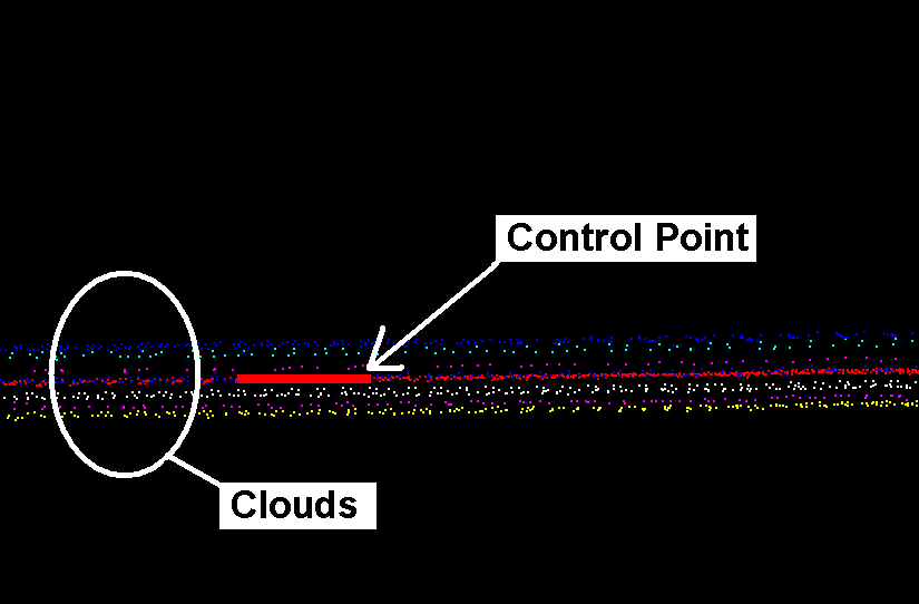
In the image below, we've color coded the different strips and are depicting the Z/Elevation axis. The eight strips present a "thickness" both above and below the respective control point. In this example, the variance between high and low is about 0.25' - or 0.13' above and 0.13' below the control point.
Using tie-lines, our processing staff links the point cloud to the ground control. The process can also be applied between an adjusted and unadjusted point cloud using "LiDAR identifiable" points (similar to a cloud to cloud registration applied in static scanning). Below is a screen capture following adjustment. The variance in the cloud is approximately 0.02' - resulting in a highly effective adjustment and providing the foundation for deriving final products.

No matter what we would like to believe, surveying is not absolute. There are errors, whether systematic or random, in each measurement. Where the differentiation lies, is in the ability to minimize or effectively eliminate those errors through field collection best practices, processing algorithms and a general appreciation of the work being performed.
No comments:
Post a Comment